Boulder County, Wapiti Trail hike
Prior to our 4th-thursday-of-November meal, Conor and I headed out for an early hike. This time we stayed local, going only to Heil Valley Ranch Open Space; a favorite destination for local mountain bikers.

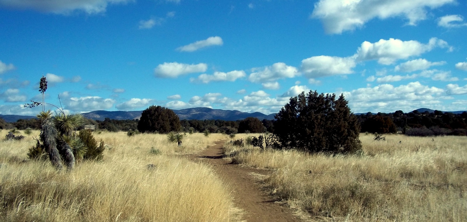
The trail starting its dance up the mountain side
Heil Valley Ranch is a foothills forest area with two main trails (Picture Rock and Wapiti trails) leading into two more loops (Ponderosa Loop and Wild Turkey Loop) for a total of about 13 miles of trail packed into 5000 acres of land. Conor and I have already hiked the 5.5 mile Picture Rock trail back in April, which is on the opposite side of the park, but neither of us have hiked this side of Heil Valley. Our plan was a simple 7-mile round trip to the top of the trail system to overlook the Rocky Mtns to our West, take a few pictures, and get back down in time for my afternoon work.

The trees part, giving us a view of Denver in the distance
We were on the trail just before 9am, just beginning to work our way up the 1000ft elevation gain when Conor spotted a few deer crossing the trail, which consisted of a dirt road at this time, and prompted a flurry of action from his camera (I have since stopped bothering to take pictures of deer, I don’t know why). Not a hundred yards down the trail a blue-jay caught his attention, then the Osprey flying low in the valley looking for it’s first meal of the day. Basically, the first half-mile was spent warming up his trigger finger for the rest of the day.

At the overlook with the snow-capped Long’s Peak in the distance
Once on the true trail, we could only point our noses to the ground and hump it up the hill. Trails here are very rocky (hence the ‘Rocky Mountains’) and you have to constantly search for your next foot hold or risk an angry ankle. This keeps us from moving our eyes up and about which in turn keeps the cameras holstered away. Occasionally the trees would part enough for us to get a glimpse of the view towards Denver to our South-East.
After 2.5 miles we reach the junction to access the Ponderosa Loop trail. About a mile down this loop was an overlook that gave us a view of Long’s Peak, 20 miles or so to our West, very near where we were snow-camping just a few days prior.
A quick snack before turning around to nearly-jog down the trail to meet my deadline to work ended the morning hike. On the way down the trail, we were constantly giving way to the now hundreds of mountain bikers on their way up the trail. Boulder-ites with a day off makes local trails very busy places. We were lucky to start our hike early enough in the morning to have the trail to ourselves (mostly). I will surely keep this in mind the next local hike I do on a holiday or weekend.